West Papio Trail
Omaha and La Vista, NE
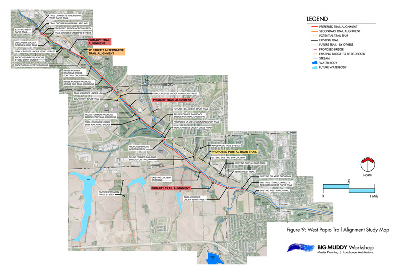
After studying various trail alignment options for a key section of the West Papio Trail, Big Muddy recommended including a rails-to-trails segment. This 3.2-mile scenic section of trail follows a portion of the original route of America’s first transcontinental railroad. This section runs along the wooded east bank of West Papio Creek for most of its length.
Several streams cross the route and historic railroad bridges were preserved and retrofitted to serve as trail bridges. This included re-decking and adding safety rails on one wooden trestle bridge, and adding new decking, safety rails and fencing at the Hell Creek girder bridge. A new stream channel grade stabilization structure was constructed at the base of the girder bridge, to prevent down-cutting of the Hell Creek. One historic bridge that was beyond repair was replaced with a new self-weathering steel bridge.
Trailhead parking areas were constructed near “Q” Street and Giles Road to provide safe locations for families to begin or end their trail visit. Near its mid-point, the trail crosses under an active BNSF rail line. An overhead structure protects trail visitors from falling debris.

The trail passes by several industrial areas and office parks. Preliminary design included determining how additional sidewalks or trail segments could connect to these employment centers to provide individuals working there with an active transportation option for commuting to work. Existing sidewalks were extended to intersect with the trail.
Interpretive exhibits near the historic Hell Creek girder bridge inform visitors about the rail line’s history and influence on community development. Benches in an overlook location allow visitors to view the convergence of the West Papio, South Papio and Hell Creeks.